dijous, 9 de juny del 2016

CREATIVA CINEMA


RODATJES A LES PLATJES, BADIES I PORTS


TRAILER SOUL SURFER


TRAILER RUNNER RUNNER


TRAILER EL LAGO AZUL


MAKING OFF EL BARCO

CREATIVE ENTRY (DICCIONARI D'IDIOMES)


LENGUAGES OF THE WORLD

I've used the same word: Bay, Port or Fiord and I've wrote the same word in all these lenguages.


BIBLIOGRAFÍA
http://tradukka.com/translate?hl=es


CONTEXT GEOGRAFIC(Creativa)


Paradise Bay, Antarctica
This is one of two places in Antarctica, where cruise liners stop (the second - this Neko Harbour). Therefore, it is one of the most visited areas of the ice continent.

FORMATIONS AND ORIGINS ( creativa )


FORMATIONS AND ORIGINS

FUNDATION OF HARBOR
Seaports of a country is one of its most important strategic logistics assets for their participation in the international exchange of goods . According to statistics from the World Trade Organization , more than 80 % of goods sold in the world by sea , by sea ports that allow this exchange.


The Port facilities spaces are calm waters that allow connectivity between maritime and terrestrial .

·Maritime or access area : Constituted by works and maritime signaling that allows the entry of different ships arriving at the port , through the main access channel. The capacity is limited , on the one hand , the width of the channels and the diameter of the inner harbor , and the minimum depth of the water .


·The land area for maneuvers : It is mainly composed of springs located in the different terminals that comprise each commercial port , based on their calling to different types of goods and which equipment available to perform the loading and unloading ships.
 

FUNDATION OF FJORD
A fjord is a narrow estuary formed in an ancient glacial valley which is currently flooded by sea water . Therefore , the bottom of the fjord is below the average sea level.

 
Most of the fjords are caused by the action of two different cases that happen at once:
 
-First : The static sea level rise , caused by the removal of ice and melting of large ice cap that covered northern Europe during the ice age .
 
-Second : The erosion of the seabed produced by the glacier itself , ice has a density that when fleet remains submerged in a large amount which can range from three-quarters nine-tenths of its total mass .
 
Interesting information:
Glaciers are able to erode their beds well below the sea surface.


FORMATION OF BAYS
A bay is a large body of water connected to an ocean or sea formed by an inlet of land due to the surrounding land blocking some waves and often reducing winds.
 
There are also bays in land environments as input to any larger body of water. Eg Pond and a river estuary , such as those found in the Great Lakes of North America or the Parramatta River estuary in Australia .
 
-A Large bay can be called a gulf and sea.
-A Creek is a coastal inlet circular or oval with a narrow entrance , some coves may be referred to as bays.


You can create bays in several ways:
 
-The Largest bays have developed as a result of continental drift . As the supercontinent Gondwana split along curved lines failure and bleeding, the continents were separated and the largest bays in the world were formed.
 
- Including the Gulf of Guinea , Persian Gulf , Gulf of Alaska, the Gulf of Mexico and the Bay of Bengal , which is the world's largest bay.
 
-another Way of bays is formed through glacial and fluvial erosion. But formed by glaciers of a bay is known as a fjord .
 
'Most of the Gulf and bays are formed by the folding of the earth's crust , such as coastal erosion due to waves and currents .
 
-The Gulf of California is an example of a bay created by the geological folding process.
 

PERSONAL OPINION:
I really liked to do this part of TDR because I learned about ports, fjords and bays.
When I looking for photos of fjords I was surprised at how nice they are.


I've also learned how to make loads and discharges from ships.
DICCIONARI DE LLENGÜES

VOCABULARY (SYNONYMS AND THEIR DEFINITION)

BAY: BAHÍA

-arm: an inlet or cove
-bayou: a marshy arm, inlet, or outlet of a lake, river, etc., usually sluggish or stagnant.
-bight: a bend or curve in the shore of a sea or river.
-cove: a small indentation or recess in the shoreline of a sea, lake, or river.
-estuary: that part of the mouth or lower course of a river in which the river's current meets the sea's tide.
-fiord: a long, narrow arm of the sea bordered by steep cliffs: usually formed by glacial erosion.
-firth: a long, narrow indentation of the seacoast.
-gulf: a portion of an ocean or sea partly enclosed by land.
 -basina partially enclosed, sheltered area along a shore, often partly man-made or dredged to a greater depth, where boats may be moored
-harbor: a part of a body of water along the shore deep enough for anchoring a ship and so situated with respect to coastal features, whether natural or artificial, as to provide protection from winds, waves, and currents.
 -anchoragea place where vessels anchor
-inlet: an indentation of a shoreline, usually long and narrow; small bay or arm. a narrow passage between islands.
-lagoon: Also, lagune. any small, pondlike body of water, especially one connected with a larger body of water.
-loch: a partially landlocked or protected bay; a narrow arm of the sea.
-mouth: the outfall at the lower end of a river or stream, where flowing water is discharged, as into a lake, sea, or ocean:
-narrows: part of a strait, river, ocean current
-strait: a narrow passage of water connecting two large bodies of water.


HARBOR: 

-wharf: the shore of the sea
-inlet
-dock: the space or waterway between two piers or wharves, as for receiving a ship while in port.
-pier: a structure built on posts extending from land out over water, used as a landing place for ships.
-port: any place where persons and merchandise are allowed to pass, by water or land, into and out of a country and where customs officers are stationed to inspect or appraise imported goods.
-road: Nautical. a partly sheltered area of water near a shore in which vessels may ride at anchor.
-anchorage
-bay: a body of water forming an indentation of the shoreline, larger than a cove but smaller than a gulf
-bight
-breakwater: a barrier that breaks the force of waves, as before a harbor.
-cove
-embankment: a bank, mound, dike, or the like, raised to hold back water, carry a roadway.
-firth
-haven: a harbor or port
-jetty: a pier or structure of stones, piles, or the like, projecting into the sea or other body of water to protect a harbor, deflect the current, etc.
-mooring: Usually, moorings. the means by which a ship, boat, or aircraft ismoored.
-roadstead: a long, narrow stretch with a smoothed or paved surface, made for traveling by motor vehicle, carriage, etc.


FIORD

-anchorage
-arm
-basin
-bayou
-bight
-cove
-estuary
-firth
-gulf
-harbor
-inlet
-lagoon
-loch
-mouth
-narrows
-sound
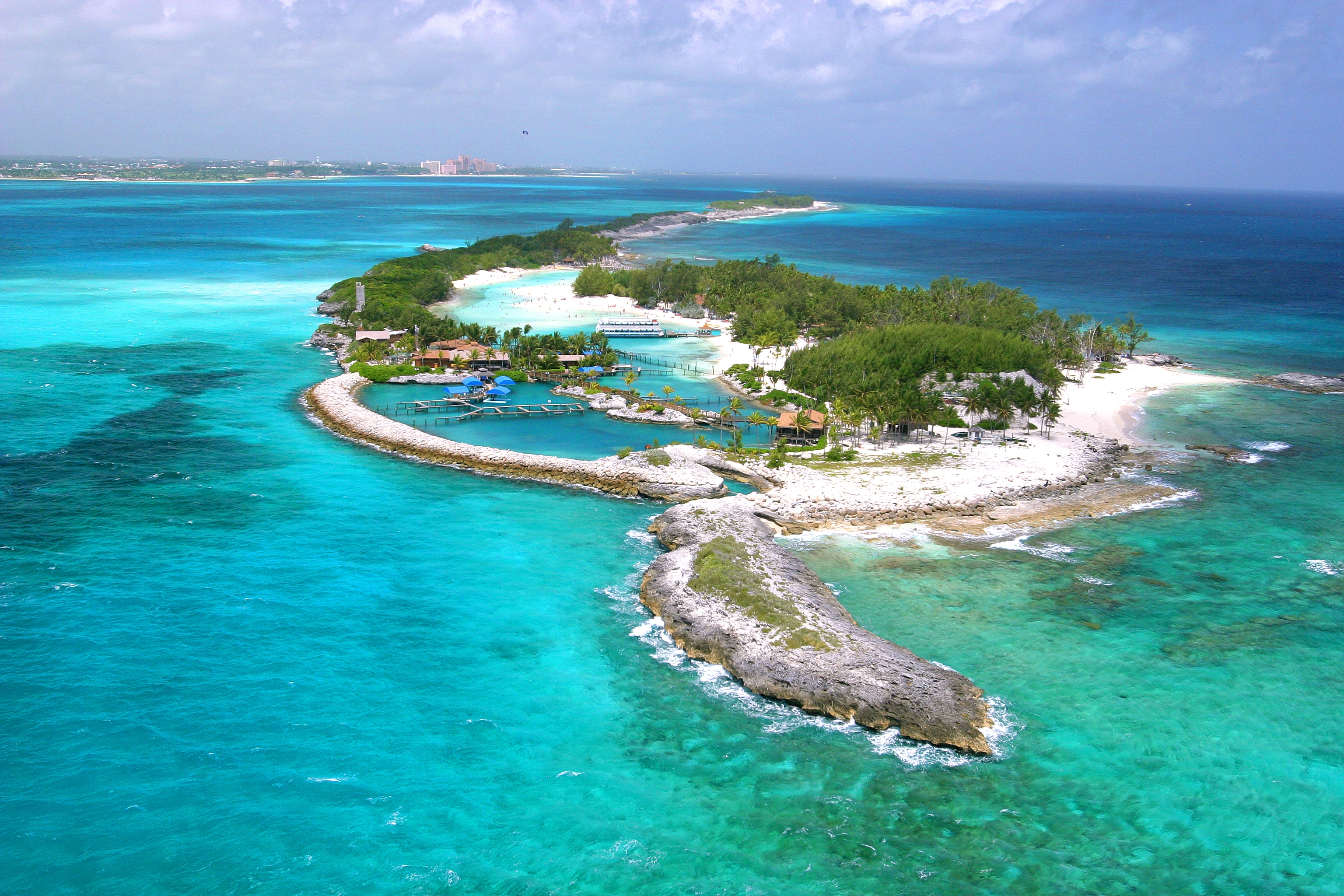
https://en.wikipedia.org/wiki/Blue_Lagoon_Island#/media/File:Blue_Lagoon.JPG
A lagoon in Nassau, Bahamas
https://www.pinterest.com/pin/392446555002532765/
A basin, partially enclosed in a mountain
https://www.pexels.com/photo/jetty-landing-stage-sea-night-3519/
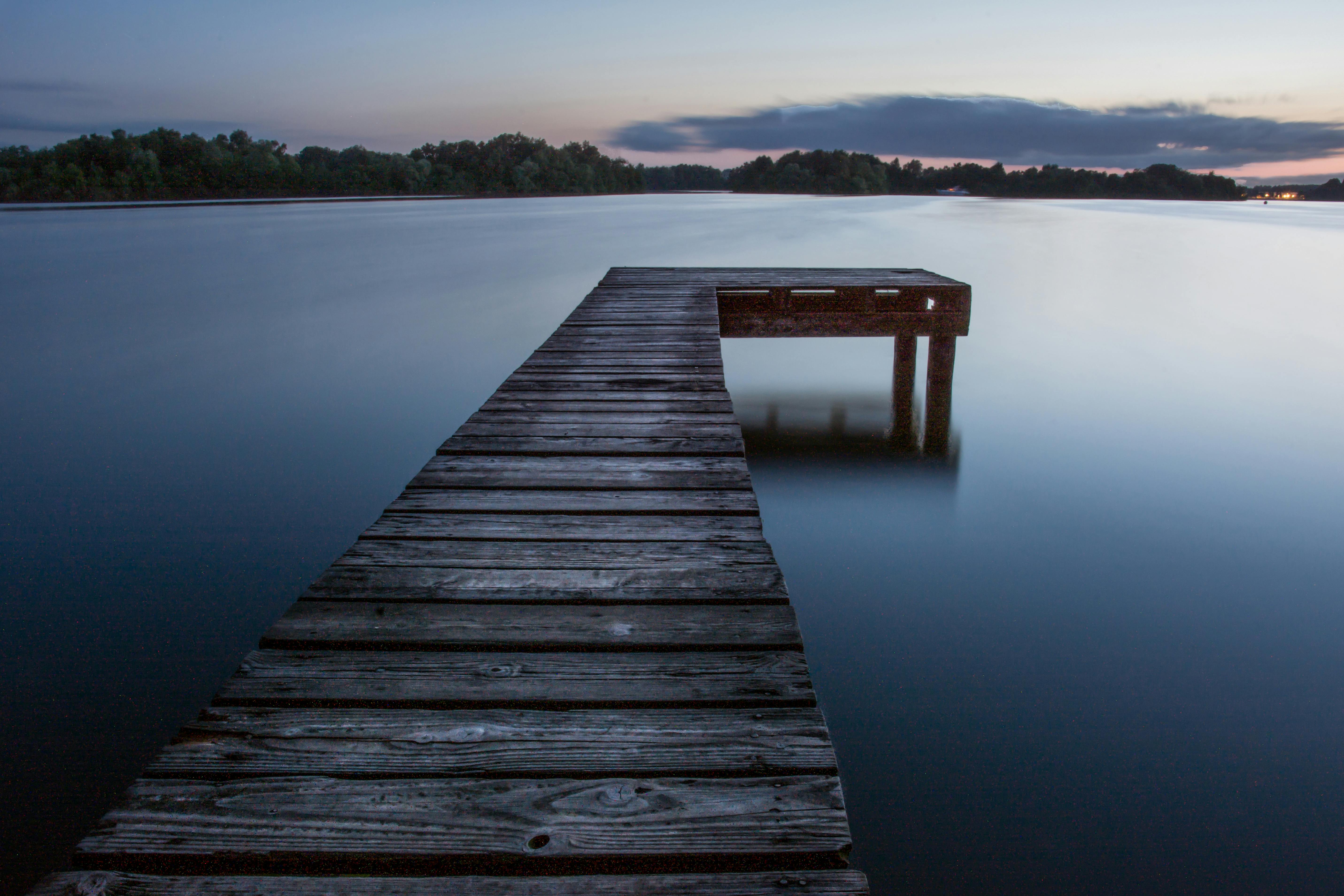
It's a jetty in Amazonas.

https://commons.wikimedia.org/wiki/File:GeirangerFjord.jpg
A fiord, a long arm of the sea bordered by steep cliffs. In Nederlands


BIBLIOGRAFÍA:


PERSONAL OPINION:

This entry has made me learn many things, different synonyms of words: Bay, Fiord and port, the meaning of each one, the relationship between them,... It is very interesting to learn so many words in English, although some do not have much relationship between them but it is important to know them for the future.
This entry in English hasn't been very hard for me, it didnt take me a long time to do it and i had fun doing it.

GEOGRAPHICAL CONTEXT BAYS, FJORDS AND PORTS

GEOGRAPHICAL CONTEXT BAYS, FJORDS AND PORTS
The most famous ports
 Singapore port
The largest seaport in the world is the port of Singapore, and, according to experts, this was the key to the active and fruitful development of the economy of the city-state. After all, quite by chance one of the priority areas in Singapore is a high-quality preparation of various port specialists, as well as providing significant security measures the port harbor.

Singapore's seaport is one of the largest ports of Asia and the world and is located on an area of almost six hundred hectares. Every year in the seaport go over 140 thousand ships, and container cargo turnover of the port of Singapore is more than 26 million cargo containers arriving from more than six ports in 123 countries around the world. Port has a favorable geographical position and because of this, more than half of world trade accounted for Singapore.


Shanghai port
A huge number of manufactured goods is constantly forcing the Shanghai Municipal Government to establish a transport system. To do this, perfectly operates two airports, three railway stations, in excellent condition are motorway.

Enormous role played by the sea port cargo turnover of Shanghai. It has direct access to the sea stretching for 18 km. This is one of the largest ports in the world.

Shanghai is working with 500 ports around the world. He specializes in container transport. For convenience, the port is divided into several business areas: port Yanshangan, Pudong container terminal, port terminal Chzhanhuaban, Tszyungunlu, Baoshan, Lun Y Luotszin, Chzhutszyamen coal terminal, car terminal Khaitun, port terminal and Minshen Guntsin. To date, the construction and modernization of terminals continues.


Hong Kong port
Hong Kong - China's naval base and a major port on the southeast coast. Located on the island and site Syangandao Dzyulun mainland to the peninsula. HMB is located in the northern part of. Syangandao, and the main port on the docking facilities Dzyulun peninsula. Court of processed at the berths and on the roads, which is located in the strait between about. Syangandao and the mainland; depth of 8-18 m. The length of berthing front of Hong Kong port 16 km with a depth of 7,2-12 m. The total turnover of marine cargo port to 33 million. tons, it is visited annually by about 7,500 ocean-going vessels.


THE MOST FAMOUS BAYS 
Paradise Bay, Antarctica
This is one of two places in Antarctica, where cruise liners stop (the second - this Neko Harbour). Therefore, it is one of the most visited areas of the ice continent. The bay is surrounded by mountains covered with glaciers and ice cliffs. Tourists here by boat between the icebergs, visit the Chilean research station, and take pictures of the penguins


San Francisco Bay, USA
The area around the bay, known as the "Bay area" - the second most populated areas of the American West: in this picturesque section of the California coast is home to about eight million people. Nature has scattered on the waters of the Gulf of many islands, the most famous of which is crowned with the former prison Alcatraz. A portion of the Golden Gate ("Golden Gate"), which enters the Gulf of the Pacific Ocean, stretches one of the most beautiful bridges in the world: the Golden Gate.


Halong Bay Vietnam
The name of this magnificent bay in the north of Vietnam poetically translated as "Bay of the descending dragon". According to the azure waters of the scattered mosaic of thousands of small islands, each topped with thick vegetation. Some of the islands are hollow inside, and the walls they form a huge cave. And this place is remarkable for its floating fishing villages.


THE MOST FAMOUS FJORDS
Geirangerfjord
Geirangerfjord - one of the most beautiful fjords in the world. It has a length of 15 km and is located in the north-western part of Norway. It is surrounded by high rocky coast with picturesque waterfalls, the most famous of which - "Bridal Veil", "Seven Sisters" and "groom". Admire the panoramas Geyrangerfoda possible, up to the observation deck, such as eg Dalsnibba (altitude 1,500 m), or along the "Road Troll" - Trollstigen. These paths are not for the faint of heart, serpentine mountain roads meander at times dangerously close to the edge of the abyss, but the views from the peaks are worth any risk. It's easy to believe in trolls, according to Scandinavian legends that inhabit these parts.


Sognefjord
Sognefjord - the second largest fjord of the world, and the largest fjord in Norway: its length - 2004 km and a depth of - 1308 m Sognefjord is located on the west coast of Norway, and is famous for its arms, the most famous of which - Neroyford 17 km long.. Neroyford narrow (its width is 300 m) surrounded by cliffs 1700 m altitude no less well-known branch of the Sognefjord -. Aurlandsford length of 29 km.


Hardangerfjord
Hardangerfjord is located in the west of Norway and has a length of 179 km and its depth reaches 800 meters, this fjord -. The longest in Norway and the third largest in the world. The surroundings abound in Hardangerfjord majestic cliffs and powerful glaciers, here lie the orchards, especially picturesque in the spring, during flowering. One of the local attractions - waterfalls, among which the most famous waterfall Voringfossen (145 m), falls from a height of 182 meters.


Personal opinion: I think it is very important to preserve the beauty of nature and to keep the natural beauty without destroying its various wastes, such as toxic waste are thrown into the sea and so on. Also very common is the pollution of the seas by means of oil leaks and other substances transported on tankers. Ports are very important for the transportation of products, a variety of matters, and other. Just wanted to note that the bays are also very frequently of muddy exposed by people who leave behind the remains of plastic and other.


BIBLIOGRAFIA: 


dimecres, 8 de juny del 2016

Música ( creativa )


FLORA (Creativa)

Deferents dipus de algues

Les algues marines es diferencien de les plantes superiors perquè no tenen tiges, fulles, arrels i sistemes vasculars veritables. En lloc d'això, s'ancoren a objectes sòlids mitjançant un òrgan anomenat hapterio o háptero i absorbeixen els nutrients directament de l'aigua, fabricant el seu aliment mitjançant la fotosíntesi.


TRADITIONS AND CUSTOMS

TDR 4ESO 2016
PORTS, FIORDS I BADIES 

Som Cristian Toscano, Andrea Cardenoso, Ana Delgado i Philip Mazein i som l'equip base 6. Anem a fer un bloc, que serà el TDR d'aquest any. Tractarà dels ports, badies i fiords. Cadascú farà tres entrades:

  -Andrea Cardenoso: Pintura, Literatura i Tradiciones i costums

  -Philip Mazein: Context geogràfic, arquitectura i flora

  -Cristian Toscano: Música, esports i formacions i origens

  -Ana Delgado: cinema, fauna i diccionari de llengües.

Cada dia crearem una nova entrada, apuesta serà tècnica i farem una que serà creativa.


PORTS 

Referencia al lloc ubicat a la costa o a la bora d'un riu on els vaixells porten a terme operacions d'embarc i desenbarc i de carga i de descarga. Aixó es possible gracies a les característiques naturals o artificials de l'área en qüestió.


                                                     www.turismodecastellon.com


BADIES 


Entrada del mar en la costa, generalment más patita que un golf; tros de mar parcialment                      envoltat de terra.


                                                         www.lookfordiagnosis.com


FIORDS


Vall d'origen glacial excavada per sota del nivel del mar després de la fussió de les glaceres, la qual forma un braç llarg i estate que penetra terra endins, de fondària considerable i pot asaolir grans dimensions. 


                                                                    institutnordic.com


BIBLIOGRAFIA


Norway
Western Norway is a region of narrow fjords that cut the high mountains ,
waterfalls that run down the slopes of the mountains and glaciers never melt. Spectacular architecture and exciting local cuisine made with ingredients, make this experience unique.
Is tradicion go to this six places:
-Fjord cruise naerØyfjord
-Preikestolen
-FlOibanen
-Trolltunga
-Bryggen in Bergen
-Subir a Kjerag


PREIKESTOLEN
ANDRIU.jpgThe Pulpit Rock (Preikestolen), the most famous tourist attraction in Ryfylke, towers an impressive 604 metres over the Lysefjord. The Pulpit Rock (Preikestolen), the most famous tourist attraction in Ryfylke, towers an impressive 604 metres over the Lysefjord. The plateau is approximately 25 x 25 metres, flat and you can enjoy a spectacular view of the Lysefjord and surrounding mountains. Along the trail, there are picnic areas and excellent bathing spots. Remember proper walking shoes/boots, walking sticks, warm clothing and food. 2 hours hike from Preikestolhytta to Preikestolen. Caption:Preikestolen i Ryfylke, Reisemål Ryfylke, H.Sundbø
https://www.visitnorway.es/listings/preikestolen-(pulpit-rock)-hike/12542/
Fløibanen

-d=1&p=37262&t=4&.jpgTake Fløibanen funicular to the top of Mount Fløyen. Magnificent view of Bergen, great children's playground and ideal for mountain walks. Take the funicular railway to Mount Fløyen and see all of Bergen in just 8 minutes. The funicular railway is one of Norway's most famous attractions. The trip starts from the city centre, just 150 metres from the Fish Market and Bryggen. The exiting trip up to the mountain is a magnificent experience in itself.  

Caption: Fløibanen vogner, Sverre Hjørnevik


https://www.visitnorway.es/listings/fl%C3%B8ibanen-the-funicular/47477/

Trolltunga

RAEH.jpgRolltunga is one of the most spectacular scenic cliffs in Norway. Trolltunga is situated about 1100 meters above sea level, hovering 700 metres above lake Ringedalsvatnet. The view is breathtaking. It is a long and hard hike. The hike is usually possible to do from mid-June, depending on when the snow melts in the mountains. Normally one can hike to Trolltunga until mid-September. Consider carefully whether you are in good enough shape and have the right equipment before setting out. There is no mobile phone coverage along the route.
Caption: Trolltunga, Scott Sporleder-Fjord Norwa

BRYGGEN IN BERGEN


aaaaa.jpgThe very first buildings in Bergen were situated at Bryggen, which has been a vibrant and important area of the city for many centuries. Bryggen has been ravaged by many fires, the great fire of 1702 in particular. It reduced the whole of the city to ashes. The area was rebuilt on the foundations that had been there since the 12th century, which means that Bryggen is basically unchanged despite the passing centuries. Bryggen is now part of our common heritage and has a place on UNESCO’s World Heritage.
Caption: Bryggen, Robin Strand
Subir a kjerag


poiuyt.jpgKjerag - the majestic mountain peak in Lysefjord , 1000 meters above sea level. Wall Mountain Aiming is perpendicular to the fjord looks perfectly from the boats on the fjord. Both climbers As the base jumpers are tempted by This comparison. Marked path from Øyagardstøl , 4 to 6 hours round trip . The terrain is difficult and demanding. Remember hiking boots , good clothing and food.
Captian: Kjeragbolten, Outdoorlife Norway, Johannes Apon


PERSONAL OPINION

This entry , traditions and customs , at first I thought it was going to cost me why it is in English, but I found a page that explained everything in English.

At first I struggled a lot to find information, but in the end I found everything.

I have learned many interesting things about Norway. I sincerely believe that this is wrong organzed TDR because we lose much time doing nothing when we finished and everything. I think we should make an entrance courtyard before and one after.


CREATIVE